Day 70 (27 miles, 6 ½ hours on the river)
October 5, 2003
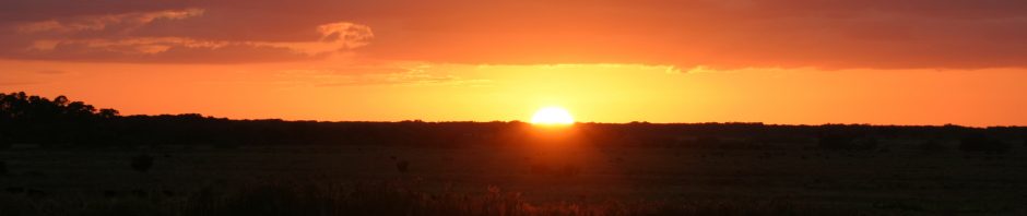
I said goodby to the Gateway Arch and shoved off my sandy bank.
Wow! What a difference a bit of current makes. I hadn’t felt a decent push since way back in Minnesota and it was really nice to feel once again how it amplifies the paddle strokes and the way it keeps moving me along even when I am not paddling at all.

Here’s a tow coming upstream under a bridge. A ‘tow’ is a collection of barges tied together and pushed from the rear by a towboat. (Photo by Ron Haines)
The river’s character is changing again. Wider, a bit of current and huge wing dams. Most of the wing dams had sand piled up behind them, a function of the current. And islands were becoming rare.
I didn’t know a thing about Kimmswick, MO, but it was only a half-mile walk from the famed Hoppies Marine, an obligatory stop for anyone traveling the river. I say ‘famed,’ because it is mentioned in most accounts of river travel in this area and is prominent in the commercial guides, such as the old edition of Quimby’s that Dave gave me in Hannibal, because of its location as a remote refueling stop and social gathering point. So even if you don’t need fuel, an exploratory stop is in order.
At the marina is a long, wide dock, running parallel to the bank, with boat tie ups on either side and a wide area in the middle for tables for socializing by the folks using the marina as a home base, or a transient stop. On land, across a connecting walkway and just up the hill, are the office and several other buildings.

Hoppies from the air, via Google
I tucked in downstream from a houseboat and tied up to the dock. There were several folks occupying the tables and as I chatted with one group I was told about tiny Kimmswick (populations hovers around 100) not too far away. So I decided to head there. (I found out much later that a cousin of someone I worked with saw me arrive at Hoppies and mentioned it to his relative, not knowing of course that he knew me.)
On this Sunday afternoon, the population of Kimmswick was probably ten times what it normally is. Close to St. Louis, it is a major tourist attraction, with several square blocks of antique and craft shops located in old residences. It reminded me of a Micanopy, FL, on steroids. There was even a tourist trolley for those who didn’t want to walk.
I found two restaurants, both overpriced in my opinion. One had a long waiting list for lunch, so I decided upon the other, The Old House Restaurant, and settled in for an $8 cheeseburger and a couple of beers.
As luck would have it I got to witness the arrival of a middle-aged motorcycle couple, resplendent in their brand new, head-to-toe matching black leathers. Watching the careful unzipping and unvelcroing as they settled in and placed their orders, after a lot of questions of their server, was well worth the $8 cheeseburger.
I left and headed back to the canoe, hoping they wouldn’t drop any catsup on the leather.
Day 71 (40 miles, 8 ½ hours on the river)
October 6, 2003

Sunrise this morning on my sandbar (Photo by Ron Haines)
A great day today. What’s not to like about a 40-mile day in a canoe? Using the GPS, I measured the current at about 2 ½ miles an hour. Paddling upped my speed to about 6 mph. With breaks and my own laziness, I was doing somewhere close to 5 miles an hour. That’s warp speed for me.
I had been thinking of stopping in St. Genevieve, MO, a tourist town with French roots, but it was a good ways off the river and the creek that would have allowed me to paddle much closer to it in a high water period was bone dry.

The photos above and below illustrate how massive bluffs along the Mississippi River are being reduced to rubble. Much of the material is used along the river to arm the banks against erosion (Photos by Ron Haines)
 The one place I knew I wanted to stop was Chester, IL. It was the closest I would get to Pinckneyville, IL, further inland. A friend from Florida who owns a house there told me he might be in Illinois when I passed through.

Chester proper is situated up on the bluff quite a ways from the river. There was a small collection of houses, Menard State Prison, and a few other buildings on the flat land just above the steep river bank and below the bluff. And, fortunately for me, just across the railroad tracks at the top of the steep hill leading down to a boat ramp was Ye Olde Landmark Inn (now a part of the St. Nicholas Brewing Company). The river bank was so high along there I hadn’t seen it from the water.

At the top of the hill up from the boat ramp was Ye Olde Landmark Inn
And even luckier for me: Though the place was normally closed on Mondays, one of the owners was there doing some work. Pam Haley, who owned it with her husband, welcomed me like a long-lost relative. She even fixed me a nice ribeye steak with all the trimmings for dinner, let me pitch my tent in the small yard behind the building and came back early the next day to make some coffee for me and see me off. She also gave me a tour of the two-story building, a bit of the history and a few ghostly stories.
It turned out my friend was still in Florida and wouldn’t be making it up to Pinckeyville anytime soon.
The trains were with me all night as I slept behind the restaurant. I was only a couple hundred feet from the tracks and there must have been a whistle about every half hour.
Day 72 (23 miles, 5 hours on the river)
October 7, 2003
With the foggy morning and my enjoying a nice cup of coffee with Pam and her husband I didn’t get away until about 10. By 3 I was out of steam. There was a heavy headwind, the summer heat had returned and the current had disappeared. I was going to have to go back to finding a shady spot for a nap in the early afternoons.

It was often impossible to tell which direction the river was going to turn (Photo by Ron Haines)
I could see more and more evidence of bluffs being reduced to rubble and carted off to who knows where in barges and trains.
I pitched my tent on a sandbar on the Missouri side of the river and it was so quiet in the evening I could hear a radio playing on the Illinois side, a half mile away.
Day 73 (30 miles, 7 hours on the river)
October 8, 2003
I was aiming today for Cape Girardeau, MO, at river mile 52, which meant I was just 52 miles north of the tip of Illinois, where the Ohio joins the Mississippi. I was meeting up with another Sierra Club volunteer, Bill Mallonee and his wife, Sheila.

Morning fog (Photos by Ron Haines)
 I planned a bit of regrouping in Cape Girardeau. I wanted to ship some unneeded stuff home and pack more water and food. From there south, the towns would be few and far between, and very likely well away from the river. I could be out a week or more in between stops.

I paddled past Tower Rock today. In higher water the currents around it can be dangerous, but today it was high and dry (Photo by Ron Haines)
The tows were bigger now and would be so from here on out. And the wing dams were now almost constant. So much for poling along close to shore on a windy day. I was out in the channel, trying to stay where the current was strongest and battling the wind.
I stopped as arranged at a boat ramp and dock on the north end of Cape Girardeau and met up with Bill. We took all my stuff with us and I chained the canoe to a tree.
Day 74 (In Cape Girardeau)
October 9, 2003
With Bill’s help I got a box packed with the canoe wheels and lots of unused clothes and other stuff to ship home. That left me some extra bag space for more food. I also bought another water container just in case.

Wing dams protrude into the water on the right bank (Photo by Ron Haines)
Feeling well prepared once again, it was sightseeing time. The Cape Girardeau downtown area is separated from the river by a huge floodwall. Only from an upper floor of a riverfront building can one see the river, so lunch on the second floor of a restaurant offered a nice view.
I was a month or so too early to witness the demolition of the old bridge across the river. Built in 1928, it was a mere 20 feet wide. A new, four lane bridge to replace it was nearly complete.
Day 75 (25 miles, 6 hours on the river)
October 10, 2003

Leaving Cape Girardeau (Photo by Fred Lynch/The Southeast Missourian)
I pushed off about 10, after a nice breakfast with Bill and Sheila and an interview with the local paper.
There was a strong headwind all day, so I had to keep paddling steadily. Fortunately it was cloudy. I took a break at a boat ramp near the tiny town of Commerce, MO. I climbed up the hill from the ramp, but never did see a town.
About 4 I spotted a nice sandbar and decided to call it a day. Thoughts about when to stop started pinging around in my mind, as they had been lately. Mentally and physically I was ready to stop, but it seemed a shame to waste all the good paddling light and that fact that the winds usually lighten up a bit in the late afternoon and evening.
An option would be to paddle early, take a long nap in the heat of the day and then go into the early evening. I had to also think about being able to find a decent place to pitch the tent before I started losing light.
All these things I batted around for several days, and in the end I settled back into what I had been doing: Getting as early a start as the morning fog permitted and moving until I felt ready to stop and had found a good place. I found I grew greater joy out of relaxing in the late afternoon and early evening light in a nice setting than trying to be super-efficient about it all.
This evening was a good example. I was on a nice wide sandbar, a long northbound tow was sitting just off the opposite shore (probably waiting for a southbound tow to navigate a corner upstream), and three young deer came out of the forest for my entertainment.

Above, sunset this evening, and, below, three deer entertain me briefly before catching my scent and moving off into the woods (Photos by Ron Haines)

Day 76 (44 miles, 8 hours on the river)
October 11, 2003
Well, that large tow idling on the opposite shore that I found so pleasant yesterday stayed there all night, so I slept with the rumble of diesel engines in the background.
There was only a light fog this morning, not enough to sock me in, so I was up and moving by 7. I encountered the first of the many huge oxbows on the river that would be nearly standard in the coming weeks. At one point I was headed northwest and took a miles long right turn and was heading back southeast. If I had felt like taking a three-quarter-mile portage across some farmland I would have eliminated 11 miles of paddling.

The morning sun struggles to burn off the light fog (Photo by Ron Haines)
A decent current offset the headwind today and I was eager to pass a milestone, the Ohio River. That would move me from the Upper Mississippi River to the Lower Mississippi River, in Corp of Engineers parlance.
Even the mile markings change. Upper river miles are counted from zero at the Ohio River and go up to 1347 at Lake Itasca. The mile markings on the lower river start at zero at the Head of Passes in the Gulf of Mexico and end at 954 at the Ohio River. New Orleans is around mile marker 100.

An upstream tow chugs past me (Photo by Ron Haines)
The meeting of the two rivers is huge. The Ohio comes in from the east, so I stuck to the western shore so I wouldn’t end up out in the middle of the junction. I had visions of chaotic river traffic. Boats coming down the Mississippi, going up the Ohio. Coming down the Ohio, going up the Mississippi. Coming up the Mississippi and taking either fork. Etc. I didn’t want to be in the middle of all those computations.
The reality was much different. The area where they met was huge, with plenty of room for the sparse traffic. I wouldn’t have gotten into trouble at all. I took a break on the Missouri shore with a nice view of the junction.

The still evening held no clue that it would get very windy overnight (Photo by Ron Haines)
Day 77 (37 miles, 8 hours on the river)
October 12, 2003
The wind woke me up at 5 this morning. It was strong and the tent was bouncing. I crawled out and put some stakes in it and went back to bed. I got up again at 7. It was still windy, but I could see it would be at my back. It was cloudy, but didn’t look too threatening, so I set off about 8. It was a bit cooler too, which was nice.

This towboat is pushing several barges loaded with huge pieces of rock from destroyed bluffs upstream. Note the red crane on the front barge. When the load gets to an area of the bank where fortification is needed, the crane is used to take the rock off the barges and deposit it on shore. In the photo below, what looks like sand on the banks on the right and off in the distance is actually rock (Photos by Ron Haines)
 The river is consistently wider now and the use of rocks and other rip rap to slow erosion and construct the wing dams was evident all over. There were fortunately still decent sand bars occasionally on the insides of the corners.


I often have the river all to myself for hours, and then along comes something, like this ferry, several of which operate along the river (Photo by Ron Haines)
I mainly stayed out in the channel and tried to catch the best current, but the river’s width was making that harder to do, particularly on the wide turns.
Day 78 (33 miles, 7 hours on the river)
October 13, 2003
I had lunch today at Reese’s Restaurant in New Madrid, MO, where I also made use of the post office and the library.
New Madrid’s on one of those huge oxbows in the river. From my southbound journey I traveled a long looping turn that took me north for miles, then a long looping turn that took me south again , and that got me back to within a mile by land of where I had started the first turn to the north. What an inefficient way to travel!

New Madrid’s at the northernmost point on this huge oxbow (Google)
It was cloudy and cool all day and I had a headwind, a tailwind, and a sidewind, you name it. It just depended on what direction I was going.
I felt like I was in rip-rap alley. Everywhere I looked the shores were armored with a layer of rock, probably from the destruction of nice bluffs upstream. And these weren’t just little piles, they went up 100 feet or so up the bank.
And the wing dams were getting larger, some of them 15 feet or so above the water. The one camper-friendly thing about them is that a wing dam usually creates a small sandbar downsteam from itself.
Tonight for example, with both sides lined with riprap, I settled for a small spit of sand on the shoreline on the downstream side of a large wingdam.

About an hour after I took a photo of this tranquil evening scene, a violent storm moved in. Note the rocks of the wing dam in the lower left foreground (Photo by Ron Haines)
Later that evening I was happy to have all the rocks around. About 8 pm the wind started howling. I knew I couldn’t trust the stakes I’d stuck in the sand to give me a peaceful night, so I set about fortifying things. I got some rope out and tied the tent down better by anchoring it to the boulders of the wing dam. Then I collected a bunch of smaller boulders and put them around the INSIDE walls of the tent.
I was glad I did all that. It was the only way I got any sleep at all. All hell broke loose about 9 when the wind picked up and the heavy rain, thunder and lightning started. I was well battened down and relaxed by that time.
Day 79 (Holed up in the tent)
October 14, 2003
The storm was still raging when the alarm went off. The rain slowed and turned intermittent about 10 am, but the howling wind kept up. Dark clouds were rolling through and there were whitecaps on the river. I was obviously going to stay put for the day. It was late afternoon before things finally cleared up.

Above, wingdam as seen from the shore. Below, another one as seen from the water (Photos by Ron Haines)
 My planned eight-day stretch from Cape Girardeau to Memphis had now become nine days, but better to be safe inside a well-fortified tent for the day than out on the river looking for shelter from a major storm.
Day 80 (34 miles, 7 ½ hours on the river)
October 15, 2003
Back to slogging today against a hard headwind.
The width of the river continued to make it hard to find even the sluggish current. And the miles-long meandering curves were another logistical problem. If I followed a more direct line and stuck to the insides of the curves it was shorter, but there was no current, and even some eddies that slowed me down and made paddling harder. Sticking to the outside of the curves meant a bit more current, but longer distance. And I had to make sure there wasn’t a tow coming upstream, as the channel generally takes them to the outside of the corners. The waves set up behind an upstream tow can be dangerous.
Many times I just stuck to the inside of the marked channel around the oxbows. That meant a longer trip than following the inside shoreline, but I could still catch a bit of current and not have to think about the tows.
All this thinking to save a few paddle strokes and muscle molecules!

A flock of white pelicans settled along the shoreline. Behind them is one of the hugh sandbars that form on the inside of the miles-long curves in the river (Photo by Ron Haines)
Day 81 (35 miles, 9 hours on the river)
October 16, 2003
Heavy headwinds all day today. The working of wind against the current sets up some nasty choppy waves that can slop water into the boat, so I have to be on my toes so I don’t get swamped. Too damn much work!
I camped out tonight in a grove of trees high above the water. It required a long uphill climb up the riprap but I decided that with this wind I didn’t want to be out in the open. I was very tired of the wind and it looked to me that there was another storm on the way.

This wingdam is constructed of pilings and then rocks dropped among them (Photo by Ron Haines)
I was really looking forward to getting to Memphis. I was going to meet up with John Focht, a photographer there with whom I had done business for decades, but never met. He was one of those genuinely nice people with whom one could have a real friendship over the phone for years. Besides, he knew more about me than anyone I’d met in weeks. I wouldn’t have to explain myself.
Looking at the map tonight I figured I was close to 70 miles from Memphis, two hard paddling days. I would be there on Saturday afternoon.
Day 82 (42 miles, 8 ½ hours on the river)
October 17, 2003
I was happy I’d chosen a sheltered spot in the woods yesterday. The storm moved in about 11 and kept up most of the night.
The morning was cloudy and cold and the wind was from the north. It looked like it was going to rain, but it never did. I had learned to be leery of clouds blown in from the west and south, but a wind from the north rarely resulted in any bad weather.
It was a delightful canoeing day. A bit of current and the wind at my back. I could stop paddling, have a snack and just enjoy the scenery and still keep moving forward!
I saw lots of white pelicans and could actually hear the wind rustle through the wings of a flock of geese as they flew over me. It’s amazing what I could hear when the wind wasn’t whistling in my ears.

Another huge load of former bluffs on its way somewhere (Photo by Ron Haines)
Day 83 (27 miles, 5 ½ hours on the river)
October 18, 2003
The fog this morning kept me from pushing off until 8:30, and even then I stayed within 30 feet of the shoreline because that was all the further I could see. It was a pleasant, surrounded-in-fog, paddle. I could hear the geese honking above me but couldn’t see them.

Another foggy morning (Photo by Ron Haines)
Because of my 42-mile day yesterday I figured I’d be in Memphis in the middle of the afternoon. And that’s what happened. Paddling into the city was a great feeling. I saw the condos up on the high bank on the north end of town that were the setting of a crime novel I’d read weeks ago. I could almost picture the protagonist (or was it the antagonist?) tumbling through the steep wooded thicket between the houses and the river.

For me, this bridge was an M as in Memphis. Below, the Memphis skyline was on my right as I paddled up to the Mud Island Marina (Photo by Ron Haines)
 I paddled under the M-shaped Hernando DeSoto bridge down to the tip of Mud Island and then back up the Wolf River Lagoon to the boat ramp and docks on Mud Island. I was happy to be off the river after this long stretch and was looking forward to meeting a friend in person for the first time.

I made arrangements to leave the canoe there and settled in for a beer on the floating dock/convenience store/marina office. John’s wife, Karen, came down to collect me and my stuff.

Carting my stuff from the canoe up to Karen’s car (Photo by Karen Focht)
Day 84 (In Memphis)
October 19, 2003
Today was a laid back, rest and recreation day. I restocked my supply of granola bars and used paperbacks, spent some fun time with John’s son and his go-cart, sent off some postcards and called home. That evening we had drinks at the famed Peabody Hotel and some great barbecue at a Beale Street restaurant.
The visit was everything I needed it to be: a nice mellow time with an old friend and his family.
Day 85 (36 miles, 8 ½ hours on the river)
October 20, 2003
Karen and her son saw me off at the marina this morning.

Look closely! This is me leaving Memphis. I am the little dot in the lower left. (Photo by Karen Focht)
It was a very good visit, but it was also great to be on the move again. I could begin to feel the end of the journey. In some ways I was ready for it to be over because of the sheer boredom of paddling all day on such a huge river. It seemed at times, especially in the long hauls without seeing any towns, to be such an inefficient and futile way to travel. I guess the positive reinforcement of a new city or town every day, and even twice a day has been keeping those feelings at bay, but they sure crept in during the nine-day trek to Memphis from Cape Girardeau.

Out on my river again (Photo by Ron Haines)
There weren’t as many tows today, only three. Some days I’d been encountering eight or ten. I am also getting fairly adept at hanging onto the current by following the channel just inside the buoys that mark it on either side.

Sunset views tonight (Photo by Ron Haines)
Day 86 (34 miles, 8 hours on the river)
October 21, 2003
Today was a long, hard slog against the wind. The current didn’t help much at all. I planned to stop at Helena, AR, and check it out.

From the angle of this tow, about a mile ahead of me, I can see that the river takes a long left turn up ahead. On the left in the distance I can also see the wide sandbar that lies on the inside of the corner (Photo by Ron Haines)
At about 3 I pulled into what’s called Helena Harbor, actually just a narrow, shallow muddy inlet off the channel that ended on the river side of the flood control embankment.
I walked to the top of the hill and there was Helena. It looked good, and probably was back in the day, but as I was to discover when I walked around, it was well past its prime. There were lots of empty storefronts and vacant blocks that once were filled with buildings and bustle. The commercial heart of the area was now further inland, away from the threat of floods, and was called West Helena.
Downtown Helena is the home of radio station, KFFA and the King Biscuit Time, the longest running daily radio show in America. It’s in the Delta Cultural Center on Cherry Street next to Bubba’s Blues Corner. They face the park that runs along the railroad tracks and the levee.
Near the intersection of Cherry Street and Missouri Street was the old restored railroad depot and Olivers Restaurant and Bar, which didn’t open until 5 pm. That seemed to be a good spot for dinner so I went off to find a hotel and a beer.
I checked into the Downtown Inn, a very old courtyard style urban motel and after walking around a while settled into a beer at a bar a block or so from the river. It had a nice juke box and some pool tables and hardly any customers.
Later on I went back to Olivers for happy hour and dinner. Jerry, the owner, made me welcome at the small bar area and introduced me around to the regulars as they came in. It was surprisingly busy for a Tuesday night.
I took a good look at the map tonight at the motel and roughed out the remainder of the trip. I would have four stops, Vicksburg MS, Natchez MS, Baton Rouge LA and then New Orleans. I estimated about a week from Helena to Vicksburg, three days to Natchez, four days to Baton Rouge and another four days to New Orleans.
It wasn’t so much that I was looking forward to the end of the trip; it was more like accomplishing what I had set out to do.
Day 87 (40 miles, 9 hours on the river)
October 22, 2003
It was pretty good paddling today, with a light headwind in the morning and a slight tailwind in the afternoon. Even the current was cooperative. I put in nine hours, but took several small breaks.
I didn’t see many tows today, but they sure were numerous during the night. What I really liked in the evening was when one of the big tour boats came by all lit up with the music playing.

These two photos illustrate the dangerous waves that are kicked up behind the tows. Waves to the side of them are nonexistent, unlike cabin cruisers and speedboats. I have read accounts of canoists and kayakers actually ‘surfing’ in the waves generated at the rear of a tow (Photos by Ron Haines)

Day 88 (39 miles, 8 ½ hours on the river)
October 23, 2003
I hit the water at 7 today. The headwind and the current pretty much cancelled each other out. In my mind and in my journal I have taken to calling this stretch The Slog to Vicksburg. This is Day 2 of it.

It wasn’t difficult to stay a long ways away from the tows on this wide stretch of the river (Photo by Ron Haines)
I saw two cabin cruisers and a sailboat this afternoon, the first pleasure craft I’ve seen since Cape Girardeau. I also saw a bit of a tow traffic jam in the afternoon. There were three or four upstream tows just idling along the shoreline. There are many corners where two tows just cannot pass each other and I think the low water has probably also narrowed the safely deep portion of the channel that they use. I suspect these were waiting for a downstream tow to clear a corner and pass them before proceeding, as those headed downstream have priority.
Day 89 (33 miles, 8 ½ hours on the river)
October 24, 2003
The headwind was strong today and I had trouble finding and hanging onto any current. The tough paddling and the heat were getting to me. I stopped and took a half-hour nap along the way and by the time I called it quits for the day I was drained.
With the big, wide river and the absence of high bluffs, there was just nowhere to hide from the wind.

As I started off this morning, the rising sun, above, glinted off of a structure of sorts downstream. Two hours later I got to it, below, a cluster of what looked like grain elevators with barges parked nearby ready to pick up a load (Photos by Ron Haines)
 A bright spot today were the large flocks of white pelicans I saw everywhere. And off in the distance there was a miles-long, undulating ribbon of small black birds going somewhere.

I’d camped out on sandbars the past couple of nights, but by the time I was ready to quit today I didn’t see any ahead at all. Finally, on the western shoreline I saw a break in a riprap and a sort of alcove with a sandy shoreline. There was a sandy plateau a few feet above the water level. It went back about 20 yards to the base of the steep shoreline and was about 30 yards long. In higher water it would not be available.
That evening before dark the owner of the adjacent farm came along with a friend who he’d been showing around. In Helena a few days ago I had seen coverage of a storm moving across the plains and I asked him what the latest was on that. It was still on the way, he said, due to hit tomorrow afternoon.
Day 90 (24 miles, 6 ½ hours on the river)
October 25, 2003
I waited for full light this morning before I shoved off. I wanted to make sure the storm wasn’t already on top of me. It was windy and cloudy, but the clouds weren’t threatening looking yet.
Just after I shoved off the farmer and his wife came down to invite me for breakfast. I gave them my regrets, saying I wanted to get some miles in before the storm hit.

The storm starts to move in (Photo by Ron Haines)
In the early afternoon I could see the clouds building and looking darker and I could hear thunder off in the distance to the west. I started looking for a sheltered spot to set up the tent. Something like last night, up against the west shore would do fine.
I was surrounded by rip rap, however. I finally just bit the bullet and went for the huge concrete slabs on the west shoreline. They were laid flat against the steeply slanted shoreline. Fifty yards up the bank, where the concrete ended, there was flat land and some woods. And the flat slabs would be easier to climb up than a big pile of rocks.
It was tricky getting the canoe stable and secured against the concrete so I could get the stuff I needed out of it. I got that done and then wrestled the still partially loaded canoe up onto the concrete so it was out of the water. I could not leave it bouncing against the concrete with waves bashing into it because it would be swamped in no time. As it was, I knew I’d have to bail a lot of water out of it if the storm came as predicted, but at least it wouldn’t sink.
Making all this more difficult was that I couldn’t bend my left knee very much. I’d felt a slight twinge of pain in the knee yesterday after my onshore nap. The dull ache of the knee had bothered me through the night last night so I had made a brace of sorts for it this morning out of a t-shirt and duct tape.
I was OK with dealing with it on land and restricting the movement, but it certainly altered my style in the canoe. Until now, for the many hundreds of miles I had covered, I sat with both legs curled tightly under my seat. That position gave me great paddling leverage and took some of the pressure off the arms and back.
Now I couldn’t do that. I had to keep the left leg sort of straight out in front of me and be careful so I wouldn’t set up some unwanted back or arm strains in the process.
By 2:30 pm I had the tent set up and the canoe secure and the storm hit. I had staked the tent down and tied it to some trees. I slid inside and hunkered down for the duration.
The storm continued on and off. During the off times I had the opportunity to fix dinner and take a short walk. It continued during the night.
Day 91 (in the tent)
October 26, 2003

The tent, above, was my home for the day today. In the photo below, looking down from the tent, you can barely see my beached canoe at the bottom of the slabs of concrete that constituted the bank. The storm raged through the night. By morning the rain had stopped but the howling wind and the dark clouds continued. It was like that front I encountered on my way to Memphis. There was no way I wanted to go out in this wind with the whitecaps on the river, so I decided to stay put for the day. (Photos by Ron Haines)

Day 92 (34 miles, 7 hours on the river)
October 27, 2003
Didn’t start off until 8:30 today. The process of bringing everything down all that steep concrete and bailing out and loading up the canoe took a long time. The knee was a problem during the night. It seemed like every time I moved from one side to the other it took a long time for the ache to subside.

It was nice to have some current and a calm day today (Photo by Ron Haines)
Fortunately for my morale, the current seemed fresher today (maybe from all the rain?) and it was cloudy and cool, with only a slight wind.

The evening sky was terrific (Photo by Ron Haines)
Day 93 (38 miles, 8 ½ hours on the river)
October 28, 2003
I got some great runs with the current today, even with a wind from the southeast.

Sunrise this morning (Photo by Ron Haines)
So far I was doing OK paddling with the left leg stretched out instead of curled under the seat. It just took some getting used to and I had my antenna up for the twinge in my back that would tell me I was putting a strain on somewhere else. It did make putting the tent up and taking it down a bit awkward, as I couldn’t go into a full squat and had to move more slowly and carefully so I didn’t twist it.
It was Day 6 of The Slog to Vicksburg. If I didn’t get pinned down by a rainstorm again I would be there tomorrow. I was planning to find a doctor there to take a look at the knee to make sure it wasn’t something I needed to take care of immediately.
Day 94 (16 miles, 5 hours on the river)
October 29, 2003

Another nice sunrise (Photo by Ron Haines)
I came to the Yazoo River shortly after noon. As I made the swing upstream on the Yazoo for the mile detour to downtown Vicksburg I stopped to chat with a fisherman who waved me over. Turns out he was visiting his uncle the other day in Memphis and was on the river and saw me when I arrived there. He said he took my picture, so I jotted down my address on a piece of paper for him and asked that he send me a print.
The Yazoo was narrow and the current not bad, so it didn’t take me long to get to the town docks and boat ramp, just upstream from a casino boat, legal only because it’s ‘floating’ in a sort of manmade swimming pool along the shoreline. Casinos in Mississippi, and several other states, are required to float. The only thing I’ve found useful about the casino boats I’ve come across is that they usually have a cheap breakfast buffet.

Downtown Vicksburg as seen from the Yazoo River. In the distance is the casino boat and just beyond that is the town dock and boat ramp, where I would be landing (Photo by Ron Haines)
The boat ramp was steep and the block-long hill to the main drag was the same. It was a strain in my knee walking uphill and I only took my small backpack. My goal was to find a beer, get a hotel, rent a car and make a doctor’s appointment for tomorrow, in that order.
I found Borrello’s on the corner of Washington and Clay. Owner and chef, Charlie Borrello, poured me a beer and welcomed me to town. Later in the day I would meet his wife, Holly, and their two sons, and a bunch of the Borrello’s regulars. It was a nice friendly bar and restaurant.
Charlie pointed me to a hotel and I went off to get checked in. The Relax Inn was about two blocks away and had a washer and dryer on the premises. I called Enterprise to get a car delivered and found an orthopedic group that I could get into tomorrow.
When I got the car I headed back down to the canoe to get what I needed. I got the laundry done and showered up and headed off to Borrello’s for happy hour, dinner and some live music.
Day 95 (In Vicksburg)
October 30, 2003
 The doctor’s office was out near Interstate 20, quite a ways from downtown. Taxi fares would have been far more than the car rental. The doctor took an x-ray that showed no bone problem and said it was probably a cartilage tear and I could probably continue as I had been and get it taken care of later. They provided me a proper knee brace and I was off to explore around. Having wheels again was sort of fun.
I turned in the car in the mid-afternoon so I wouldn’t get charged for another day and set off to find someplace interesting for a late afternoon drink and dinner.
I ended up in the old residential section of town, about three blocks from the hotel, and found the Walnut Hills Restaurant. It was in a nice, 1880’s era residence and had a great wide front porch with rocking chairs. Perfect for a lazy afternoon.
In the course of the evening I chatted with a woman who said that earlier that day she’d met another person canoeing the river. She been introduced by a friend to the paddler and his wife, but didn’t recall the name or know where they were staying.
On the way back to the hotel I stopped in at Borrello’s and said goodby to Charlie and Holly and thanked them for all their hospitality.
Day 96 (33 miles, 8 hours on the river)
October 31, 2003
I got an early start this morning, all my batteries recharged. I figured two days, or maybe two days and a bit, to get to Natchez MS, where I planned another rest stop. Could it be I was getting lazy?
It was cloudy, warm and humid this morning and the sun came out in the afternoon and really heated things up. The river was very wide, of course, and the current sluggish, but the wind wasn’t a factor.

It was a wide open river today, interrupted by the occasional tow, below (Photos by Ron Haines)
 I camped tonight with a view of the cooling tower at the Grand Gulf Nuclear Power Plant. There were deer tracks everywhere on the sand bar I chose, but they all stayed in the nearby woods while I was there.

Day 97 (38 miles, 8 hours on the river)
November 1, 2003
It was a nice, quiet foggy morning, the kind of day I could hear the birds flying above me but couldn’t see them.

The sun finally started bursting though the fog about 9 this morning (Photo by Ron Haines)
It was a great, pretty straight ride directly south today. The breeze was very light and I managed to hang onto a decent current. I made such good time in fact that I pulled into Natchez shortly after 4.
I investigated some landing spots near the floating casino, but was quickly shooed away by security, so I ended up at the end of a long, steep boat ramp just upstream from the casino boat.
The main part of Natchez is up on the bluff a ways from the river. Closer to the river, at the top of the hill from the boat ramp is what’s called Under The Hill, a three-block collection of former taverns, gambling houses and whorehouses from the great old days of life on the Mississippi. They lined the street that ran parallel to the river, and all had a terrific view of the water.
Today there was a restaurant or two, some shops and the Under the Hill Saloon with the Mark Twain Guesthouse above it. What more could a canoeist ask for? Who wanted to pitch a tent when I could have a room above the bar with a view of the river? The bar was quiet this late afternoon, but it was Saturday and there would be live music and a big crowd later on.
Andre’ Farish Sr. bought what was then a bar/general store back in 1976 and restored it to its present incarnation. The building is thought to date back to the late 1700’s.

Front Street, Under The Hill. The red car is parked in front of the Under the Hill Saloon. Downhill to the right is the Mississippi River, which curves to the left and goes under the bridge seen in the background (Photo by Ron Haines)
I had a couple beers and arranged for a room upstairs. And then I headed back down to the canoe to get what I needed for the night. On the way down the long ramp I saw a yellow fiberglass canoe pull up.

Everett’s yellow canoe and mine down at the end of the long steep boat ramp (Photos by Ron Haines)
It turned out to be the fellow I’d been told about in Vicksburg. His name was Everett Briggs. He and his wife, Hollie, and their dog, Sahara, had paddled from the headwaters of the Missouri out west to St. Louis. He was now on his way to New Orleans solo. I’d been only an hour or so ahead of him all the way from Vicksburg. He too had a view of the nuclear plant cooling tower from his campsite last night.
Hollie and Sahara were now traveling with him by car and she would be along later tonight to pick him up. They were staying somewhere in Natchez proper. We hung out a bit that evening and made arrangements that they would pick me up in the morning for some sightseeing.
My evening Under The Hill was as good as it gets. A nice bar, good music, friendly people, a clear starry night, all overlooking the Mighty Mississippi River. And then the American Queen cruise boat, a huge floating concoction of balconies and lights and music, pulled in later on, just to make things perfect!
Day 98 (In Natchez)
November 2, 2003

The American Queen tied up at Natchez. In the foreground is the boat ramp and my canoe and Everett’s (Photo by Ron Haines)
Everett and Hollie picked me up about 11 as planned and we toured a few plantations and downtown Natchez. With my knee hurting from the walking I did up and down that boat ramp hill yesterday I was glad I had a ride up the hill to Natchez proper.
They were off to dinner with some friends and I hung out in Natchez for a while, then walked back to the Under The Hill area.
I was ready for an early start tomorrow.
Day 99 (38 miles, 7 hours on the river)
November 3, 2003
I was starting to taste the satisfaction of actually accomplishing this. At the rate I was going I’d be meeting my friend Maurice in New Orleans in about a week. I had one more planned stop, in Baton Rouge, where I’d arranged to meet up with some more Sierra Club folks.

More wide open river today (Photo by Ron Haines)
It was a great paddling day, no wind and a decent current.
As I set up camp on a sandbar on the west bank, I saw Everett paddling along, at least a half mile away from me out on the water. Because of the way sound travels on the water we actually had a short conversation, the words as clear as if we’d been ten feet from each other, until he was out of range.
Day 100 (41 miles, 9 hours on the river)
November 4, 2003
Making decent time, but working harder at it today than yesterday. No wind in my face, fortunately, but it was hot and the river was wide and had more curves today. It was harder to hang onto the current.

Sunrise today (Photos by Ron Haines)
Day 101 (31 miles, 7 ½ hours on the river)
November 5, 2003
Another tough day of slogging. The river is huge, the current hard to find and the sun intense.

Miles away in the haze and glare is an upstream tow (Photo by Ron Haines)

Interesting clouds in the sky today (Photo by Ron Haines)

This old pair of grain elevators was converted to housing at some point, judging by the window air conditioners and the refrigerators and washing machines on the balconies. The huge gash on the right was probably from a runaway barge during a high water period (Photo by Ron Haines)
Day 102 (19 miles)
November 6, 2003
I met Sierra Club volunteer John Engelsman at midday at our rendezvous spot on the western shore, not too far from his house in Baker, a northern suburb of Baton Rouge. We packed everything into his pickup truck.
After a couple beers and a shower, I went out to dinner with John and his wife, Kathy, and three other Sierra Club members.

The tows are huge, consisting of up to 35 barges tied together with thick cables and winches. On the Upper Mississippi their size was constrained by the width and length of the locks (Photo by Ron Haines)
Day 103 (27 miles, 7 hours on the river)
November 7, 2003
John put me in at a boat ramp near the bridge in Baton Rouge. It’s that bridge, the Huey P. Long Bridge, that keeps ocean going ships from going north of Baton Rouge on the Mississippi: they can’t fit under it.
From here to New Orleans would be a boring slog through a shipping channel. Shipping terminals, loading docks and huge cranes lined the banks, barges were everywhere, and ocean going ships moved up and down the river. The tugs that serviced them were faster than the towboats I’d been used to and left huge wakes, worse than the cabin cruisers I’d encountered upriver.

Fast-moving ocean ships are part of the equation now (Photo by Ron Haines)
The wind was in my face all day long and the ugly, depressing commercial river I was now on didn’t help my mood.

Even this busy commercial stretch has some decent places to camp out (Photos by Ron Haines)

Day 104 (38 miles)
November 8, 2003
I was pushing myself along. I’d told Maurice I’d be there Monday and that worked out because that was his day off. And I was just getting tired of the surroundings.
Maurice Coman and his wife, Barbara, were Sierra Club members too. He and I had worked together a bit in Florida before he moved to New Orleans. It would be good to see him again.
As I passed a line of barges tied up along the shore, someone called my name. It turned out to be a paddler named Jim from Indiana who’d been camped there a couple days. Everett had told him I’d be along. We chatted briefly, but I was not in the mood to stop. Upstream a month ago, I probably would have happily hung out with him for a few days.

The photos above and below show a very busy river (Photos by Ron Haines)
 I found a spot for the night on a sandy bank behind some parked barges. There was just nowhere else to go to get away from all this.

Tomorrow was Sunday and I wanted to meet up with Maurice on Monday, so I had to do some 60 miles in two days, seemingly doable if I could count on racking up the daily mileage I had been doing. But I decided to put in a long day tomorrow just to be sure. I set the alarm for 4 am.
Day 105 (35 miles, 11 hours on the river)
November 9, 2003
What a miserable night! I got up twice to pull the canoe up higher because the huge waves from tugboats kept pushing it around. The activity was constant, the honking of tug boats, the clanging of hatches on barges, the roar of huge cranes.
When the alarm went off I was more than ready to get moving. I hadn’t paddled at night on this trip and in this busy commercial area I quickly realized it wasn’t a terrific idea. I had no marine radio to let folks know I was there and didn’t have running lights. All I had was a flashlight that I flashed around if I thought a tug was going to move and hadn’t seen me. There were lights everywhere. All the terminals had lights. At one point some lights that I thought were a terminal up ahead turned out to be the lights of an ocean-going ship moving fast upriver in my direction. Fortunately I was just off the channel, so it wasn’t on a collision course with me, but if it had been I would not have been able to get out of the way in time.
 I was really happy when the sky lightened. It was a tough, lousy day. On top of the nerve-jarring nighttime beginning I had no current, high winds and high waves all day long. At the end of 11 hours I was really beat and found a sandy shoreline that was miraculously not occupied by shipping terminals and lined with barges.

And most fortuitous of all a fisherman came along while I was setting up the tent and offered me a beer!
So I had a good ending to a long miserable day and only 25 miles to cover tomorrow. I felt like a kid on the night before Christmas!

It was a very busy river indeed (Photo by Ron Haines)
Day 106 (24 miles, 8 hours on the river)
November 10, 2003
The wind and waves knocked me back to 3 miles an hour today, but I didn’t mind. I knew at the end of the day I would have completed what I set out to do: paddle down the Mississippi River.

Minutes from the end of the voyage (Photo by Maurice Coman)
Maurice met me at our rendezvous point with a bottle of champagne, arranged by my wife. I would stay with the Comans and head up to Minnesota by train to get the car and head back south. We had a nice celebratory dinner with some friends of theirs. No big party in the French Quarter, I’ve been there and done that, just a nice time with nice people and the happy feeling that WOW! I DID IT!

And here I am, the final image of me on the river. Note the big grin! (Photo by Maurice Coman
EPILOGUE
I took Amtrak from New Orleans to Minneapolis and Bill Melby picked me up…with my car! I was pretty happy to see it, and to look forward to a long pleasant road trip. I followed the Mississippi south to New Orleans, on back roads as much as possible, picked up the canoe and my stuff at Maurice’s in New Orleans and headed back to Florida.

Safely home! (Photo by Sue Haines)


Ron,
Wow, what an incredible journey–great to get it all chronicled too.
LikeLike
Hey Ron! I just finished reading the entire account of the trip. It was excellent, and provided very valuable information. I am planning on doing this trip in the late summer of 2012. What was the average cost of a hotel room on the river?
I can’t wait to get to the headwaters and start my own journey, thanks for writing this!
LikeLike
I kept track of that but can’t find that particular piece of paper. I’d guess at $50, and I only stayed in one every week or so. If I find the precise info I will send it. Meanwhile, keep in touch because I want to hear about your planning and your trip. And ask me any questions you want. Cheers and thanks for the nice comments. Ron
LikeLike
I thoroughly enjoyed your blog. It brought back many memories from my trip last year. i am going back in a week’s time to drive down the river nad try to catch up with all the people that were so kind to me on my voyage. You can read about my trip if you google Musselman’s mississippi kayak adventure
LikeLike
Hi Greg,
Thanks for your kind words about my account of my paddling down the river. It took me nearly ten years after doing the trip to finally stop the procrastinating and get out the journal and the photos and the map and put it all down in a fashion that might be interesting and a decent read for the many friends and members of my family who knew I did it, but for whom I had never provided a decent account.
I went through your blog today.
Glad the folks you met were helpful and friendly. I found the same thing. I have traveled a lot and have always had faith that the average person one encounters will be a friend, not a foe, and I was happy that proved true on the Mississippi, again and again.
Your river, high water and current, was much different than mine, low water and little current. It meant I worked hard most days paddling against the wind on nearly still water, but it also meant campsites were easy to find and the river was very forgiving if I made a stupid mistake.
All the best. Consider you have a friend in southeast Florida and I will consider the same if I ever make it out to where you are.
Ron
LikeLike
Just been re reading your blog. I have plans to paddle in Florida one day as I have a friend who has just moved to Sebastian from NY. At the moment all my concentration is on this year’s trip New York to Chicago starting towards the end of May. There will be a blog entitled Musselman’s Great Lakes kayak Adventure which I am in the process of setting up
LikeLike
Hi Greg, Let me know how to keep up with where you are. I will be in Connecticut for several months beginning in early May and depending on where you are going to be in New York we may be able to meet up for lunch or something. And especially let me know about FL, as there’s no reason why I couldn’t find a way to travel with you a bit if that’s OK. Ron
Ron Haines cell 561 315-0528 https://ronhaines.wordpress.com/canoeing-the-mississippi-river/ Sent from my iGarage
LikeLike
Hi Ron,
Great blog. Really great to see the real life day to day of a trip down the river. I myself am planning a trip late this summer and have a few questions. I was wondering if there is a place that I can email some questions to? Any help would be great!
Nate
LikeLike
Ron, For 35 years I have wanted to put a canoe on that river. This last September my son and I did a short 67 miles, Cairo to New Madrid in a couple and a half days. All the fast rivers and the Canadian boundary water lakes were great practice but this thing was beyond all expectations. I have no immediate intentions to do the entire river but do plan to do 5 day trips intermittently…as I am still employed and cannot do more. At any rate, your story was fantastic and though I cannot relate to the length of your trip, I have gleefully experienced an amazing journey. Thank you
Craig- Northwest Arkansas
LikeLike
Thanks for the nice comments Craig. Glad you enjoyed it. If you have any questions about the river that aren’t answered on the site, just let me know. Happy to help.
Ron
LikeLike
My brother and I are planning a river trip to start in August of this yeare (2013). rather than canoe, it will be via a pontoon boat equipped with bunks and cooking facilities in a snug cabin, complete with electronics, gps, charts, marine radios, and a computer or two. Our trip will start in Bellevue, Iowa, down to the Ohio river, up the ohio and then the tennesse river, crossing Kentucky Lake, and end up in Florence , AL where we have a winter home. see our website at;;;;
http://rivertrip13.wordpress.com/
will be starting in mid-August and take 4-6 weeks. Enjoyed your blog and think I have gleaned a lot of info on it that we can use on our trip.
Stan Cornelius
LikeLiked by 1 person
Have a great trip Stan. I’m ‘following’ your blog now. Feel free to add a link to my trip in your ‘other trips’ section if you want. I am also following Linnea and her friend this year. Ron
LikeLike
Hey Ron, I really enjoyed reading about your journey! I’m starting my trip over my summer break from school. Thanks for sharing and I’ll be sure to pack a rocking chair and bucket!
LikeLike
Have a great trip. And let me know if you set up a blog or something so I can see how you’re doing.
LikeLike
I was researching guides to paddling down the Mississippi when I came across your site. I could not stop reading about your trip, it was a great read and served as a very comprehensive guide. I am glad you include such details as how to portage around dams and get throughlocks. Congratulations and I hope one day I can set out to accomplish this myself.
LikeLike
Glad you liked the site, Jacob. I hope too that you can do this trip someday.
LikeLike
This is a great story, Ron. Sorry I missed your presentation at the library back in Florida (I’m in New Jersey now). By the way, my great-grandfather was a mule trader on the Mississippi. I never knew him; my grandfather had no kind words for him, felt he had killed his mother with overwork and child-bearing. His father transported mules up and down the river on rafts. My grandfather was a farmer on the Alabama-Mississippi border, and produced everything his family needed. A loaf of sliced bread from the store was a rarity.
LikeLike
I really enjoyed reading your account of the river. I paddled Itasca to the gulf in 2008 at age 54. Started Sept 16 and took 89 days. I had a partner from Itasca to St. Paul and solo the rest of the way. I was in a 17′ Alumacraft. The volume of the canoe was nice for carrying a load. It was also nice to have the stability and high sides during waves. I was probably a little more lightly loaded than you were and was using a graphite bent blade paddle. I noticed how thin you were upon completion. I am
6’5″ and lost 36 lbs during the trip ending at 186 lbs. I flew to Bemidji from my home in Austin, TX and bought the canoe there. I paid a fellow to take us over to Itasca. I dropped off my car in Venice, LA prior to beginning the trip. Like you I meet many interesting people along the way. Many are still friends and facebook friends. I have stopped by to see several of them over the years.
LikeLike
Thanks for the note, Robert. Congratulations on your trip. Sounds like our experiences were similar, including a nearly identical weight loss! Did you do a journal or post pics anywhere? If so, put the link here so others can see it if you want. In Bimidji, I actually bought a bent shaft paddle, but never really got the hang of it so didn’t use it much. Nowadays I use a double-bladed paddle (240 cm long). Very efficient. Wish I’d had it on the Mississippi.
LikeLike
Hi Ron, I appologize. I am not sure why the wedding video keeps comming up when I try to post the Mississippi River Trip. Will you please remove the previous two posts.
If you really want to see the video, go to youtube.com and search “youens mississippi river” it will come up first thing.
Thanks,
Robert Youens
LikeLike
I will do that, thanks.
LikeLike
WOW! I am absolutely in awe of this trip. I have been thinking about doing this for a while. Im purchasing a touring kayak next month, and am going to start training. to leave in May of 2016. What an inspiration your story is! I have so many questions!
LikeLike
Glad you’re enjoying the read Jeff, and hope you get to do it all yourself. Don’t forget to let me know how to follow you along the way (if you want to be ‘followed’–I didn’t). And I am happy to answer any questions you have. Best, Ron
LikeLike
Thank you for sharing your amazing journey!
LikeLike
Happy you enjoyed reading about it, Roy.
LikeLike
fantastic story. thoroughly enjoyed reading of your voyage. just wish I had attempted something like this this when I was younger. shocked you were so trusting and didn’t get anything stolen. I would have been petrified to leave my stuff unattended. any idea how much trip cost?
so what’s the next great adventure? I rafted down the Grand Canyon–should try that in your canoe. looking forward to our next sailing excursion.
Steve
LikeLike
Didn’t keep track of costs, Steve, but it was about like living anywhere would be. Groceries, a hotel every couple of weeks, a restaurant meal every few days, bar tab once a week, gas to get from FL to MN, train fare NO to MN and then gas to get back to FL.
LikeLike
I am not an outdoors person but I love geography and history and stumbled across your site googling images of the MS River. I am amazed by your adventure and by the way you are record your journey in a way that makes me feel I was a witness. What an accomplishment! I found myself smiling while reading! Thank you for the experience!
LikeLike
Thanks, glad you enjoyed it.
LikeLike
I just read through all the entries. Great story. Congrats on your incredible accomplishment!
LikeLike
Thanks, glad you enjoyed the read.
LikeLiked by 1 person
Ron, I stumbled across your blog as I have just began researching making a trip down the Mississppi. It was exactly what I needed to get a realistic idea of what the trip would be like. Your writing and details were really well done, thank you!
-Al
LikeLike
Al,
Happy you’re finding it helpful. You can email me (ronaldhaines@bellsouth.net) if you have any questions. And definitely let me know if you end up doing it. I highly recommend it, obviously.
Ron
LikeLike